 |
Haverford Heritage Trail |
Directions from Previous Site: Continue along St. Denis Lane past Eagle Road, make left onto Cherry Lane. House will be on right.
Physical Address: 224 Cherry Lane, Havertown PA
GPS Coordinates: 39.99328, -75.30677
Parking: On street
Ownership: Private
Arcadia Book Page: No
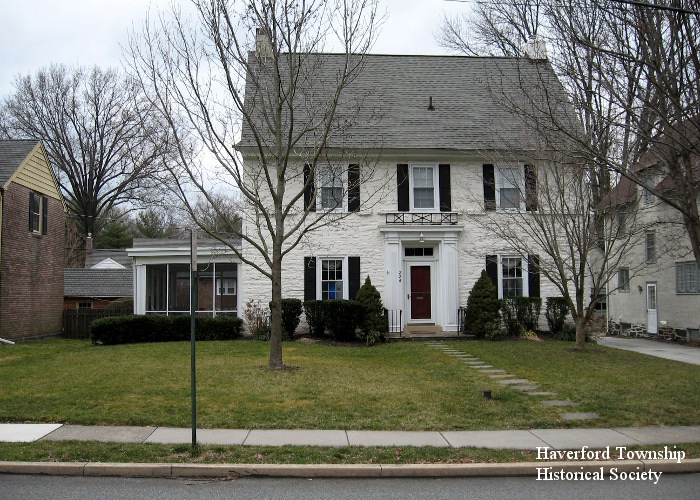
Description and History: This house, now surrounded by a suburban neighborhood, was part of a 124 acre farm left to Mary Kelly Ott and her husband, Jack Ott, by Mary’s father Dennis Kelly. The area became known as Ott’s Valley and in the 1920s was developed into the present day neighborhood of Merwood Park. The land had belonged to the Welsh settler Daniel Humphrey since 1703, and a Humphrey "mansion house" on it which had become neglected was finally torn down by Dennis Kelly in the 1860s. The Ott house was built about 1820 and is stucco over stone. The “belt course” visible just under the second story windows is the remainder of a stone ridge that once supported a one-story porch roof across the front of the house.
NOTE: Choose here to continue on Main Trail or take Haverford College Option Trail to Site H1.
|
|
|
|