 |
Haverford Heritage Trail |
Directions from Previous Site: Continue along Golf House Road past end of East Course on right to College Avenue, turn right and proceed past Spring Mill Lane on left. House is in distance on left before bridge over rail line.
Physical Address: 620 College Avenue, Haverford PA
GPS Coordinates: 40.00856, -75.31594
Parking: No
Ownership: Private
Arcadia Book Page: No
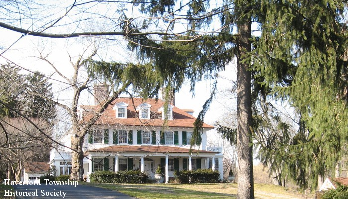
Description and History: In 1807 Samuel and Sarah Garrigues purchased a large tract of land, which according to the deed included a tenant farmhouse, plantations and a “grist mill, saw mill, mill and gear works and all dams, traces [and] improvements.” Haydock Garrigues later purchased the property and operated a mill and brickyard at its northeast corner, near the origins of Cobbs Creek. The tract became known as Millbrook Farm. It contained the main house (built about 1850), as well as the older tenant farmhouse (about 1807) and a carriage house/stable (about 1900). By 1913 the property was reduced to 12 acres and owned by Mrs. D.B.C. Catherwood, with springhouse, greenhouse, vegetable garden, sunken garden and tennis court. The property was subdivided in 1984 and the tenant farmhouse and carriage house/stable are now separate residences on Spring Mill Lane.
|
|
|
|