 |
Haverford Heritage Trail |
Directions from Previous Site: Main Trail: From Craig Hall, reverse direction on Coopertown Road, then left onto College Avenue a short distance to right onto Meadows Lane, then left onto Williams Road. Haverford College Option: From Friends School Haverford and Meeting House, make left onto Buck Lane. Proceed downhill to traffic light. Cross Haverford Road and go uphill to Coopertown Road. Continue across onto Meadows Lane, then make right onto Williams Road. Both: Continue along Williams Road to Darby Road, then cross Darby onto pathway along right side of Parkview Drive to roundabout at Community Park at Haverford Reserve.
Physical Address: Parkview Drive, Haverford PA
GPS Coordinates: 39.99577, -75.34080
Parking: Spaces and lots along Parkview Drive
Ownership: Varies
Arcadia Book Page: No
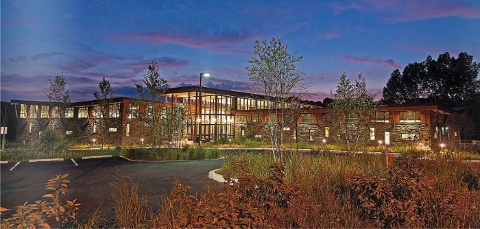
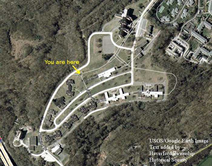
Description and History: In 1964 the Commonwealth of Pennsylvania built a large, modern multi-building state hospital facility on a 209 acre tract of land in northwest Haverford Township. This land had previously been part of millionaire and township resident A. Atwater Kent's "Foxcroft" land holdings. In 1998, with attitudes changing toward deinstitutionalization and community-based care for the mentally ill, the hospital was closed. The Commonwealth offered the property to Haverford Township, and after a drawn-out and contentious process in the township a development plan was agreed upon. The result was the sale of some acreage for residential development, with the sale proceeds funding township development of large active and passive recreational open areas, including playing fields, wooded trails and meadow spaces. The tract of land is now known as Haverford Reserve, and the recreational facilities comprise Community Park at Haverford Reserve. A new Community Recreation and Environmental Center (the “CREC” building, shown above), featuring “green” design and a geothermal climate control system, is situated where the state hospital once had its coal-fired steam plant with smokestack (lower left corner of the image below, which shows the former hospital buildings and roads (thick lines) in comparison to present-day roads (thin lines).
|
|
|
|