 |
Haverford Heritage Trail |
Directions from Previous Site: Continue along Steel Road, then right onto Greenview Lane, then left onto Gilmore Road, then right on Prospect Avenue to bend onto Joanna Road, at which point the last remains of the filled quarry can be seen. Then proceed down Joanna and left onto Olympic Avenue.
Physical Address: 330 Olympic Avenue, Havertown PA
GPS Coordinates: 39.968920, -75.30215
Parking: On street
Ownership: Private
Arcadia Book Page: 86
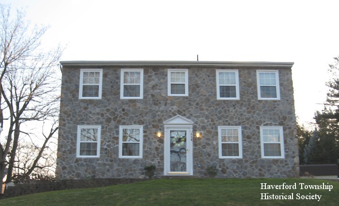
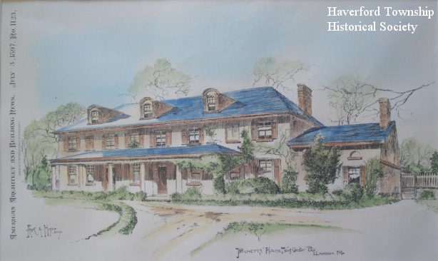
Description and History: Originally, a small colonial house, built to the “Penn Plan” or “Quaker Plan” style recommended by William Penn, existed on a 162 acre tract of land. In 1797 it was incorporated into a larger estate house known as "Richland" (shown below) by architect Frank A. Hays for W. C. Pritchett. (Hays and his firm also did a number of architectural designs for large homes in the early Llanerch suburban subdivision.) The Richland estate house was later converted into multi-tenant housing. It was subsequently demolished in 1991 and the estate was subdivided and filled with the suburban homes seen today (see above). A deep quarry adjacent to this area, along Township Line Road, was established in 1924 by Vincent DiFrancesco. The Llanerch Quarry included a massive industrial structure where the rock was crushed to gravel. It was located alongside the carbarn and yard of the Philadelphia Suburban Transportation Company (also called the Red Arrow Lines), now the location of Kohl’s department store. The quarry flooded in the 1970s and was closed. The site is now filled in and developed as the “Quarry Center” shopping area.
|
|
|
|