 |
Haverford Heritage Trail |
Directions from Previous Site: The house is behind and above the first railroad bridge abutment, overlooking Darby Creek. The best view is the one shown below, as one heads to Site 21, except in winter when one can see it through the trees from curving Darby Creek Road.
Physical Address: 300 Marple Road, Haverford PA
GPS Coordinates: 39.99090, -75.34247
Parking: No
Ownership: Private
Arcadia Book Page: 22
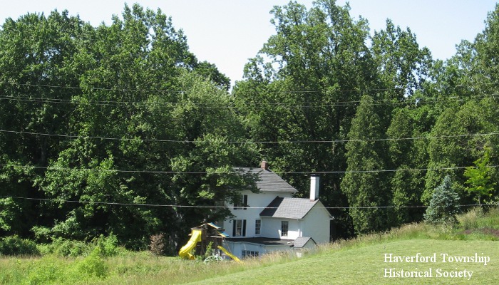
Description and History: The smaller rear portion of this stucco-over-stone house dates back to about 1790, at which time it was owned by Philip Moore. The larger portion was added about 1840. The house features a large walk-in fireplace with original crane and rare Pennsylvania yellow pine floors. Also on the property, which is located on a hill overlooking Darby Creek, are a springhouse and a stable/garage. The “Brookthorpe” part of the name by which it is presently known is tied to the Brooke family, which owned land in pre-Revolutionary War times along the east side of the creek, and also to the later Brookthorpe Farms, a huge 1600 acre landholding assembled in the early 1900s which extended from Darby Road westward beyond Darby Creek into Marple Township. Today there is a roadside “Brookthorpe” cast monument sign in Marple on West Chester Pike near North New Ardmore Avenue. “Brookthorpe” was also the name of an estate house built in 1921 for J. Stanley Reeve on Darby Road in Haverford near College Avenue, so the Brookthorpe name covered a lot of land. The “Station” part of the name comes from the railroad branch line which passed by the house, even though the nearby “Brookthorpe” railroad flagstop actually had its own separate waiting shelter.
|
|
|
|