 |
Haverford Heritage Trail |
Directions from Previous Site: Main Route: From
Llanerch Junction, cross Darby Road and proceed left on Darby, turn
right at base of hill onto East Park Road, then left onto Lansdowne
Road, then right onto Llandillo Road. Proceed on Llandillo, cross Valley
Road and uphill one block, then right onto Twin Oaks Drive. The Glen is
on the right at the bend. Narbeth Option: From the Cook Estate,
continue along Manoa Road, then turn right onto Pembroke Road and
follow. The Glen is on the left at the bend.
Physical Address: Twin Oaks Drive and Pembroke Road
GPS Coordinates: 39.97460, -75.29252
Parking: On street
Ownership: Haverford Township
Arcadia Book Page: No
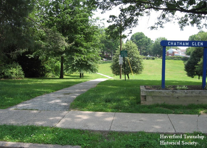
Description and History: In the early 1900s the Pennsylvania Railroad hatched a plan to relieve growing congestion on its main line between Philadelphia and Harrisburg. Called the Darby Creek Low Grade Line, the idea was to divert freight trains onto an alternate route that would also provide a more efficient, less steep gradient up from Philadelphia. Although the line was never built, PRR acquired 70 percent of the needed land and thereby changed suburban development patterns dramatically. The “Pennsy” owned a large triangular tract, with Manoa Road and Earlington Road (then called Lewis Road) basically forming the two shorter sides, and the angled back edge of Llanerch (Valley Road and later Juniper Road) defining the longer hypotenuse, where the twin tracks would have been placed. Eventually the railroad created a golf course on this site for its employees (see scorecard below). After World War II, the Pennsylvania Golf Club property was sold off for housing developments, including the neighborhoods of Chatham Park and Chatham Glen. A small triangular piece of land where three development areas met is today Haverford Township’s Chatham Glen Park (shown above).
|
|
|
|